Blog GIS & Territories

GIS coaching for territorial management.

  • Blog – English
  • Tutorials
    • Leaflet Initiation
  • All Content
  • Old Maps
  • Plugins QGis(en)
    • FuzzyAttributes(en)
  • About/Contact
  • English
    • Français
    • English
    • Español
    • Português

Author: Atilio Francois

4 June 20254 June 2025 Atilio Francois No Comments
  • Postgis
  • PostgreSQL

ENC maps in QGis with Postgis(1)

This subject comprises two articles. The first deals with importing ENC S57 files into a Postgresql/postgis database. The second deals with setting up an automatic symbology equivalent to nautical charts. You can download all the scripts…

Read More
28 May 202528 May 2025 Atilio Francois No Comments
  • PostgreSQL

Postgis:table with multiple geometries

List partitioning in PostgreSQL/PostGIS is a declarative partitioning method that divides a large table into several sub-tables, according to the discrete values of a column (e.g. by region, type, year, etc.). This is particularly useful in…

Read More
23 May 202519 May 2025 Atilio Francois No Comments
  • webmapping

Leaflet: responsive

At the end of the Leaflet introductory course, the final mini-project looked like the following map: With a map displaying geojson data, a mini-map and a title. This screenshot was taken on a PC and looks…

Read More
21 May 202519 May 2025 Atilio Francois No Comments
  • webmapping

MBtiles & Leaflet

Introduction: What is the MBTiles format? The MBTiles format is a file format for storing map tiles (raster or vector) in a SQLite database, a lightweight, stand-alone database engine. Initially designed by Mapbox, this format has…

Read More
16 May 202519 May 2025 Atilio Francois No Comments
  • webmapping

Leaflet tutorial: session 6

Session objectives: Creation of a mini-mapping project The aim of this session is to mobilize all the skills acquired in the introductory course to Leaflet to create a complete interactive map. Learners choose a theme from…

Read More
14 May 202511 May 2025 Atilio Francois No Comments
  • webmapping

Leaflet tutorial: session 5

Slide 1: Key events in Leaflet In Leaflet, events play a key role in making maps interactive and responsive. Indeed, Leaflet can handle a wide range of events that occur on the map, layers or specific…

Read More

Posts pagination

« Previous 1 … 3 4 5 6 7 … 52 Next »

Mastodon Follow me on Mastodon
Voir le profil de atilio francois sur LinkedIn

Recent articles

  • Converting a raster into fuzzy values with FuzzyAttributes V2
  • Consultation and negotiation: the contribution of fuzzy logic
  • PostGIS 3.6 released – 3D, raster, and topology take a leap forward
  • Creating awareness maps with QGIS: the equivalent of the Above and Below style
  • From Boolean analysis to fuzzy logic in a GIS: a concrete example
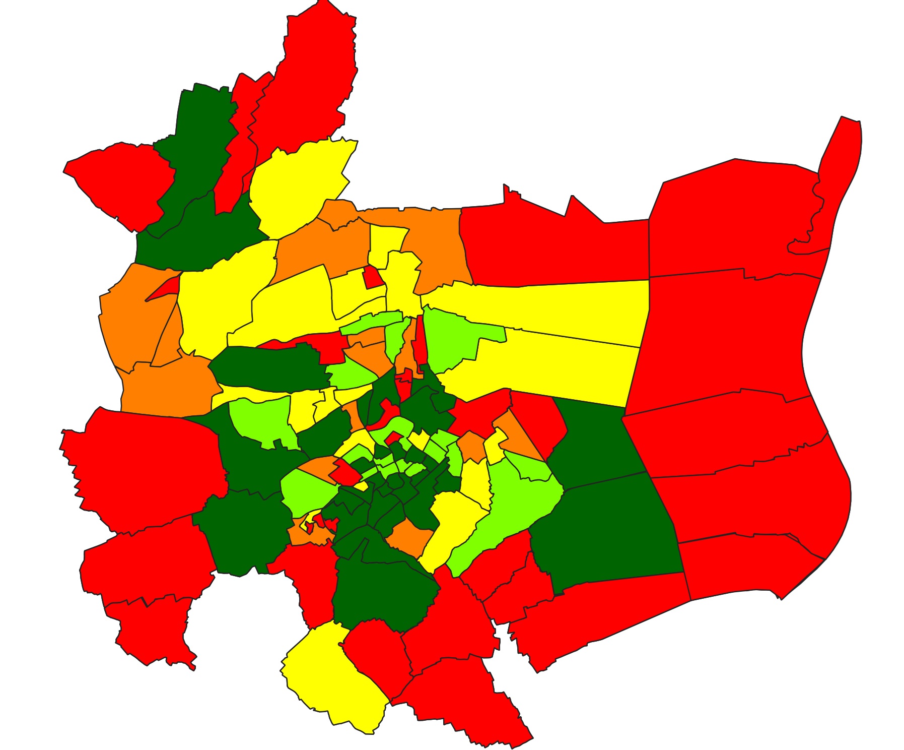
Recent comments

  1. Atilio Francois on How to develop an application with pgrouting in Windows (1)25 August 2025

    You're right — since 2019 Geofabrik no longer provides plain `.osm` files, only the compressed `.osm.pbf` format. The tool **osm2pgrouting**…

  2. Simon on How to develop an application with pgrouting in Windows (1)25 August 2025

    The osm downloads don't appear to be available, just osm.pfb And osm2pgrouting on Windows doesn't like pbf "not well formed…

  3. Arno on Portable version of QGis 3.32.021 August 2025

    I just want to thank you. It works.

  4. Atilio Francois on Portable version of QGis 3.32.015 May 2025

    What is the link between the qgis update and the portable version? A portable version cannot be updated; it must…

  5. Hugo on Portable version of QGis 3.32.014 May 2025

    For me, the error message complaining that qgis_app.dll is missing started appearing following the most recent QGIS update.

All articles by category (click on a category to display article extracts)

(You can copy the RSS link for each category separately)

  • ArcGis (1)
  • Arcgis Pro (1)
  • bibliography (1)
  • Database (12)
    • PostgreSQL (9)
    • Spatialite (3)
  • english posts (20)
  • Felt (3)
  • Geoserver (5)
  • GIS and management (2)
  • Lidar (10)
  • Logique floue (1)
  • Non classé (206)
  • Outils divers (2)
  • Postgis (2)
  • QGis (59)
    • Plugin (15)
  • webmapping (9)

  • Blog – English
  • Tutorials
  • All Content
  • Old Maps
  • Plugins QGis(en)
  • About/Contact
  • English
Copyright 2018. All rights reserved | Theme: Blog Mantra by LilyTurf Themes