New Felt plugin for QGis
Felt has just released a new plugin for the QGIS community: Add to Felt. QGIS users can now create Felt maps directly from QGIS projects thanks to the new QGIS plugin.
Read MoreGIS coaching for territorial management.
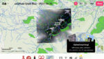
Felt has just released a new plugin for the QGIS community: Add to Felt. QGIS users can now create Felt maps directly from QGIS projects thanks to the new QGIS plugin.
Read More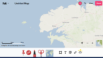
FELT (https://felt.com) is a new collaborative online mapping platform. The platform offers modern tools for creating maps that are easy to make and share. Registering with FELT First of all, FELT is free to use. But…
Read More
What is WMTS? A good example of a WMTS service is OpenStreetMap. It consists of an address to which client programs can request geotagged images. When you load OSM into QGis, the program connects to the…
Read More