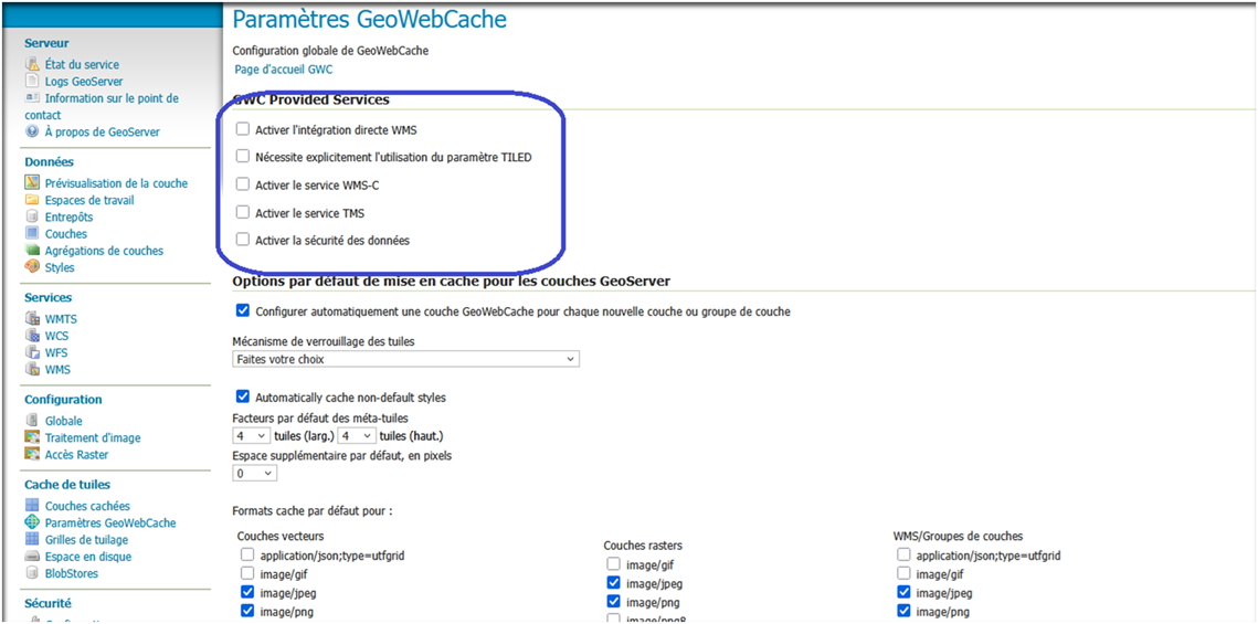
Geoserver:configuring geowebcache(2)
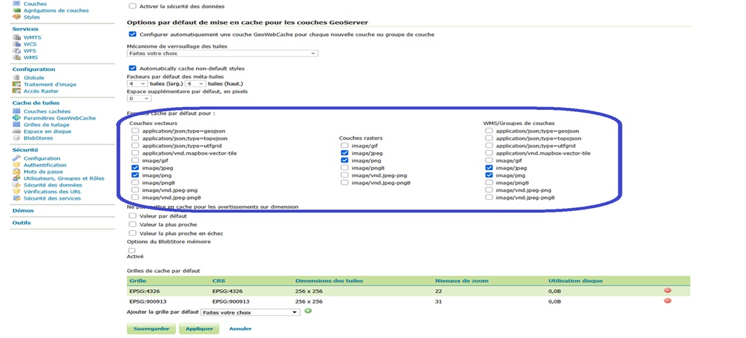
GeoWebCache (GWC) tile formats available in GeoServer GeoServer, as an open source mapping server compliant with OGC (Open Geospatial Consortium) standards, offers several types of web services for the distribution of geospatial data. One of the…
Read More