Leaflet tutorial
Duration: approx. 9-12 hours (divided into 6 sessions) Program : Expected result By the end of the course, you’ll be able to create a working Leaflet map with your own data and put it online to…
Read MoreGIS coaching for territorial management.

Duration: approx. 9-12 hours (divided into 6 sessions) Program : Expected result By the end of the course, you’ll be able to create a working Leaflet map with your own data and put it online to…
Read More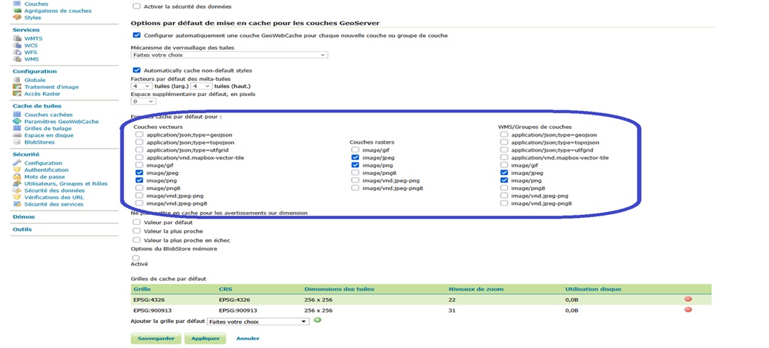
GeoWebCache (GWC) tile formats available in GeoServer GeoServer, as an open source mapping server compliant with OGC (Open Geospatial Consortium) standards, offers several types of web services for the distribution of geospatial data. One of the…
Read More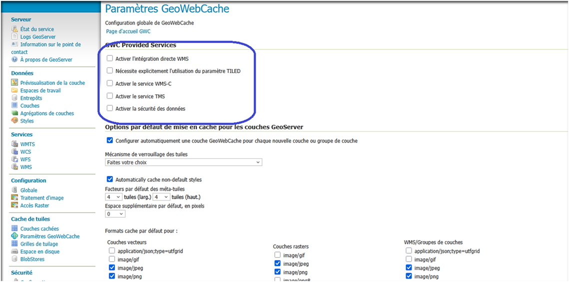
Services available with GeoWebCache (GWC) in GeoServer GeoServer, as an open source mapping server compliant with OGC (Open Geospatial Consortium) standards, offers several types of web services for the distribution of geospatial data. One of the…
Read More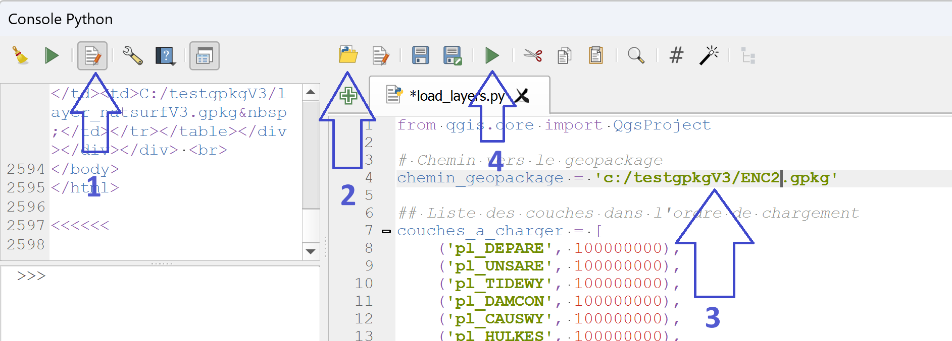
This article completes the series of articles on creating a geopackage database to manage ENC nautical charts in QGis and the symbology of the various data layers. Working with a small number of maps presents no…
Read More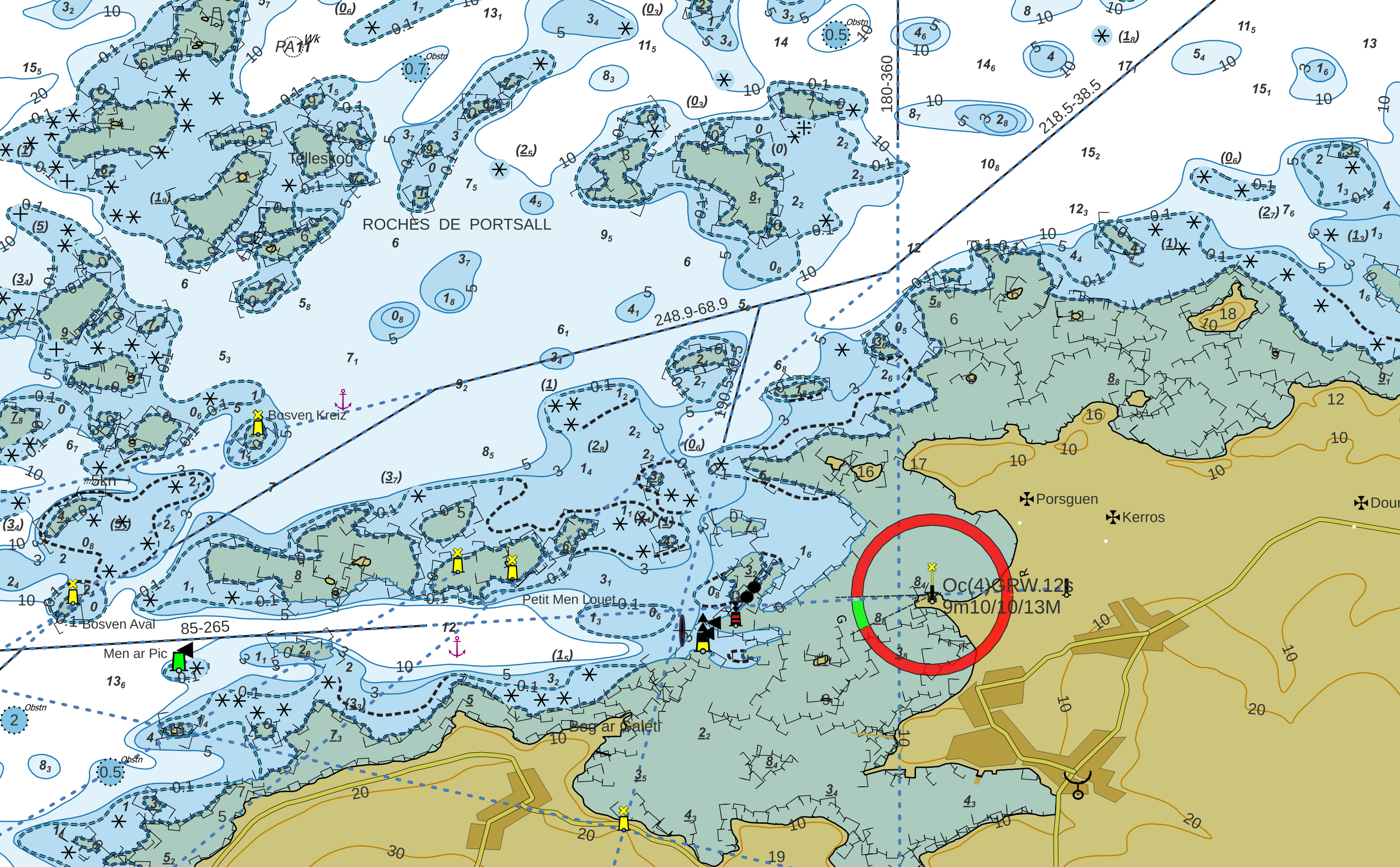
The project to integrate ENC maps into QGis in the form of Geopackage is now complete. This article completes the two previously published articles on ENC symbology in the Geopackage database. Adding symbology to Geopackage The…
Read More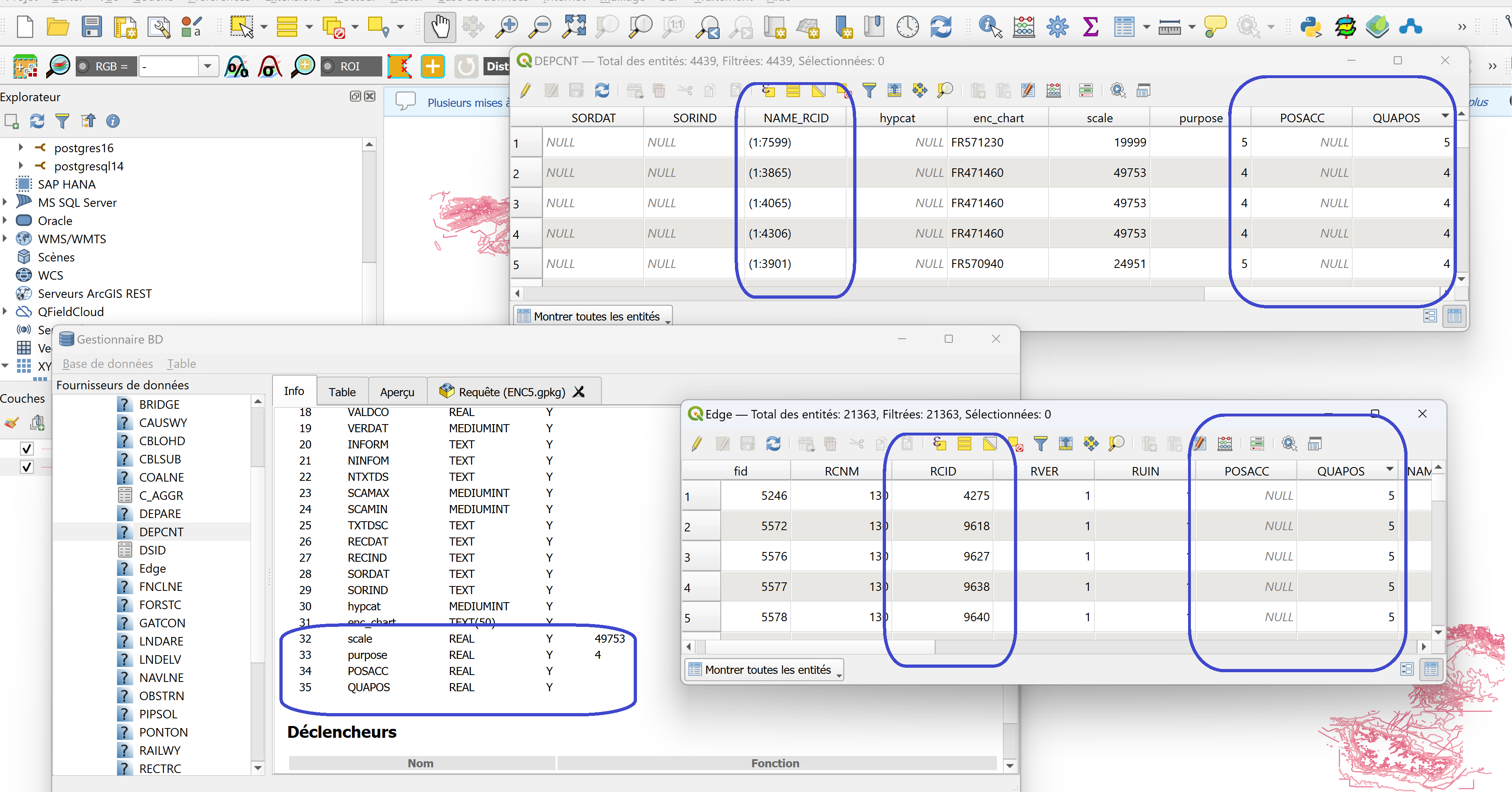
The project to integrate ENC maps into QGis in the form of Geopackage is now complete. This article completes the two previously published articles on setting up and managing the Geopackage database. In the first article:…
Read More