[EN]Exploring ENC Data Before Import: The NOAA Catalogue at the Service of S57Manager
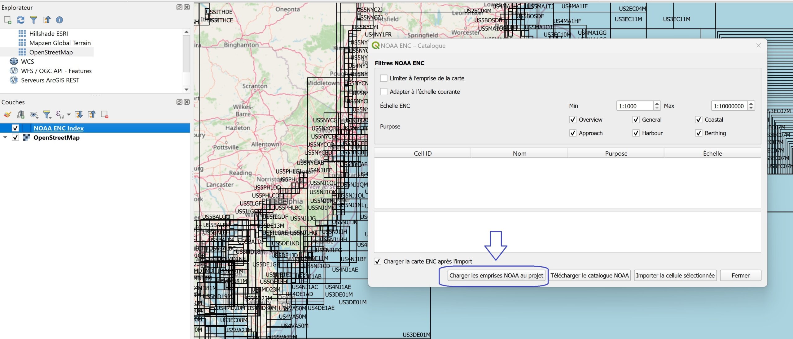
Working with ENC (S-57) data presents a very specific challenge: their richness and complexity make any “blind” approach inefficient. Even before discussing data import or structuring in QGIS, a fundamental question arises: which charts should be…
Read More