Blog GIS & Territories

GIS coaching for territorial management.

  • Blog – English
  • All Content
  • Old Maps
  • About/Contact
  • Forums.
  • EnglishEnglish
    • FrançaisFrançais
    • EnglishEnglish
    • EspañolEspañol
    • PortuguêsPortuguês

Tag: cloudcompare

8 August 20238 August 2023 Atilio Francois No Comments
  • Lidar

QGis for LIDAR: digital terrain model (DTM) with CloudCompare.

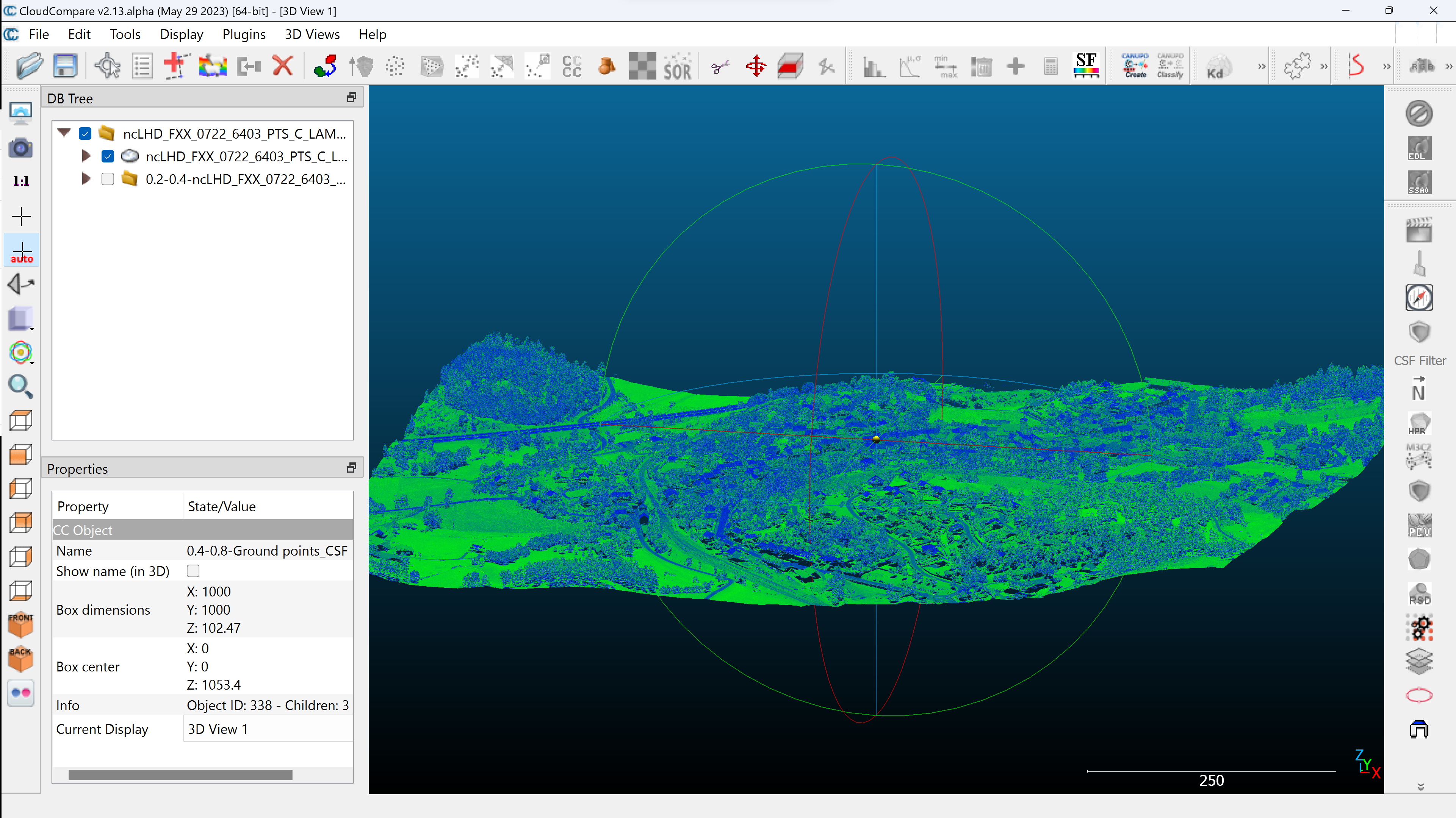
QGis for LIDAR:digital terrain model (DTMIn this article you will find the definition of a digital terrain model and, step by step, how to create a DTM from an unclassified and classified LIDAR cloud, using CloudCompare…

Read More
3 August 20233 August 2023 Atilio Francois No Comments
  • Lidar

QGis for LIDAR: digital surface model (DSM) with CloudCompare and LAStools

In this article you’ll find the definition of a digital surface model and, step by step, how to create a DSM from an unclassified and classified LIDAR cloud, using CloudCompare and LAStools. Tutorial : LIDAR HD…

Read More
27 July 202328 July 2023 Atilio Francois No Comments
  • Lidar

QGis for LIDAR:colorizing from an image

Tutoriel : LIDAR HD avec QGIS 3.32 In this article you’ll find out how to transfer colors (colorize) from an image or orthophoto to the points of a LIDAR cloud using CloudCompare. The result is an…

Read More
25 July 202326 August 2023 Atilio Francois No Comments
  • Lidar

QGis 3.32: Tools for LIDAR data

Tutorial: HD LIDAR with QGIS 3.32 In this article you’ll find tools for LIDAR data: LASTools, WhiteboxTools, OpenLIDAR Tools. Step-by-step installation, licensing and configuration. You’ll also find a presentation of CloudCompare. As we saw in the…

Read More
  • Blog – English
  • All Content
  • Old Maps
  • About/Contact
  • Forums.
  • EnglishEnglish
Copyright 2018. All rights reserved | Theme: Blog Mantra by LilyTurf Themes