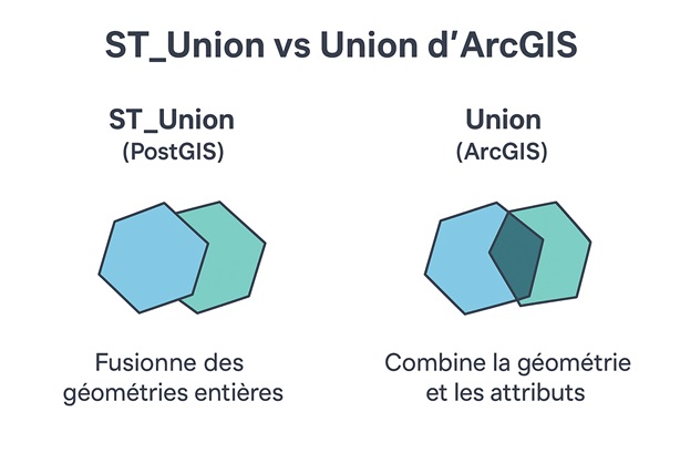
Union in GIS: choosing between overlay, merge, unary union, and dissolve
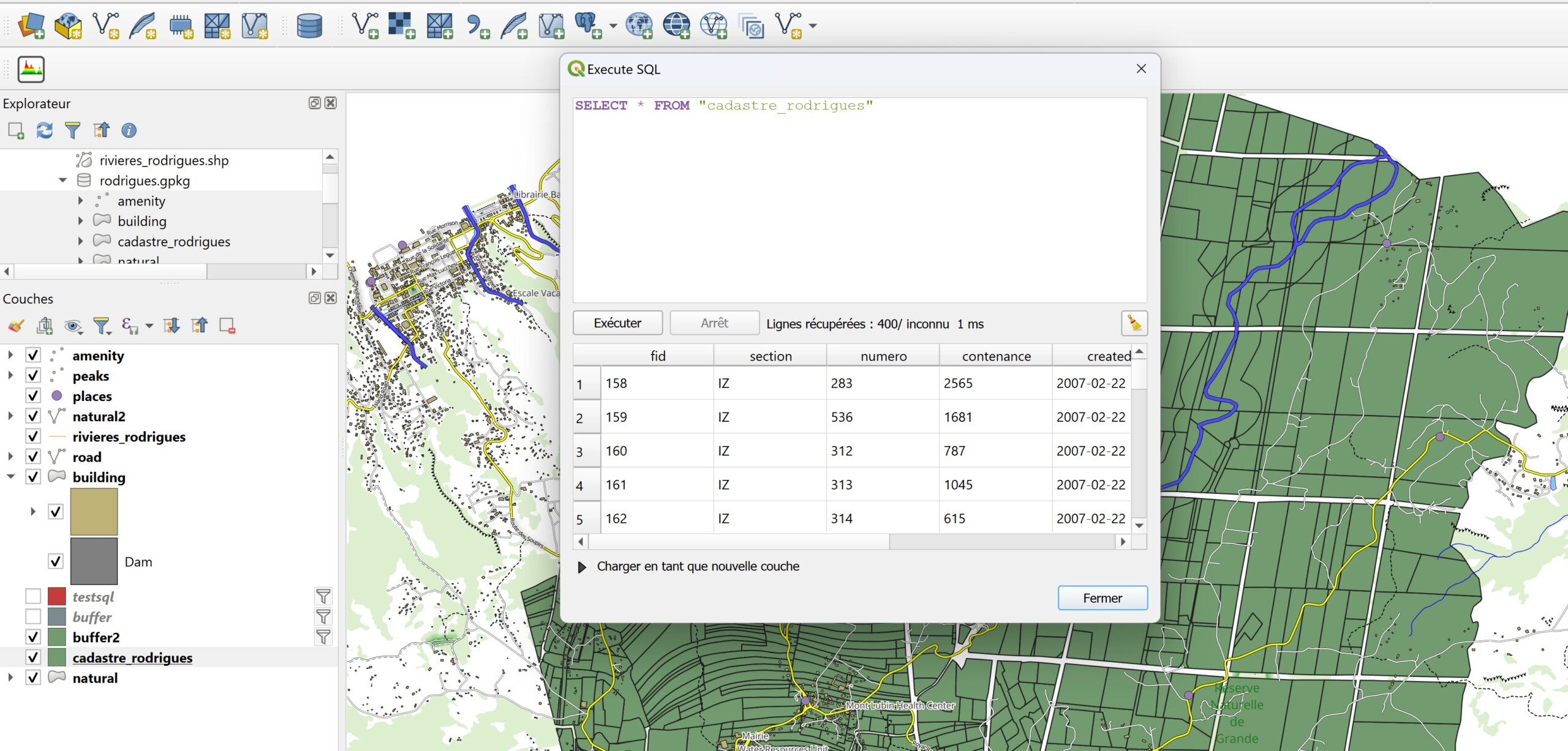
Understanding the different types of unions in GIS Spatial union is one of the fundamental operations in geomatics. It allows you to combine multiple layers or entities to produce new geometries or enrich attributes. However, behind…
Read More