Blog GIS & Territories

GIS coaching for territorial management.

  • Blog – English
  • Tutorials
    • Leaflet Initiation
  • All Content
  • Old Maps
  • Plugins QGis(en)
    • S57Manager(en)
    • FuzzyAttributes(en)
  • About/Contact
  • English
    • Français
    • English
    • Español
    • Português

Category: QGis

17 May 202320 May 2023 Atilio Francois No Comments
  • QGis

QGis Green View Index plugin tutorial

The Green View Index for QGIS is a plugin that performs the three main procedures necessary to calculate the GVI for a given area: We are publishing a series of three articles: 1-Green View index concepts…

Read More
16 May 202320 May 2023 Atilio Francois No Comments
  • QGis

The Green View Index plugin in QGis

The QGIS Green View Index plugin is a powerful tool for measuring the vegetation cover of a given area. It is easy to use and provides valuable information to urban planners, landscape architects and environmentalists. By…

Read More
9 May 20235 May 2023 Atilio Francois No Comments
  • QGis

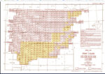
Perry-Castañeda Library-southern europe 1943 maps: How to georeference?

The Perry-Castañeda Library Map Collection, located at the University of Texas, is one of the largest digital map collections in the world. This collection contains maps of all continents and many countries, as well as topographic,…

Read More
2 May 202324 June 2023 Atilio Francois No Comments
  • Felt
  • QGis

Integrating a WMTS raster tile service in QGis 3 and Felt

What is WMTS? A good example of a WMTS service is OpenStreetMap. It consists of an address to which client programs can request geotagged images. When you load OSM into QGis, the program connects to the…

Read More
1 May 20232 May 2023 Atilio Francois No Comments
  • QGis

How to find the coordinate system of a layer with QGis 3.X?

When working with spatial data in GIS software, you regularly encounter the problem of files that lack a clearly defined coordinate system. When a file lacks its coordinate system (CSR), it can lead to misaligned layers,…

Read More
  • english posts
  • GIS and management
  • QGis

Python Methods for QGis: how to examine vector data

Once a layer is loaded, usually we want to access the data included in the layer, whether the geometries or the attributes. Now, we will discuss how to code in Python the access to these two…

Read More

Posts pagination

« Previous 1 … 11 12 13 14 Next »

Mastodon Follow me on Mastodon
Voir le profil de atilio francois sur LinkedIn

Recent articles

Recent comments

posts

  1. Atilio Francois on [EN]Portable QGIS 4.0 for Windows – Download and use QGIS without installation5 June 2026

    Thank you for your feedback and for reporting these issues. The errors and the missing Processing functionality that you observed…

  2. Andrea on [EN]Portable QGIS 4.0 for Windows – Download and use QGIS without installation5 June 2026

    I've downloaded today the 7z file from https://www.sigterritoires.fr/QGis4.0Lite, then unarchived it and then launched launch_qgis_portable.bat: various errors occurs https://dcmnt.eu/pad/#/2/pad/view/-6FZXEyJYV4SyZmDWWE4XW6M7l-1JGp0V67X4tBTdjg/embed/ and…

  3. Andrea on [EN]Portable QGIS 4.0 for Windows – Download and use QGIS without installation5 June 2026

    It's not clear what are exactly the components that are missing in the "QGIS portable – lightweight version". Could you…

  4. Ed on Portable version of QGis 3.44.0 – Updated Version with Python Fixes and Authentication Support2 June 2026

    Thank you for your service to the community! Please know that you are greatly appreciated! We prefer using the Long…

  5. SERGIO SEBASTIAN VERDU on [EN]Portable QGIS 4.0 for Windows – Download and use QGIS without installation27 May 2026

    Hi Atilio, I'm very interested in downloading these versions of QGIS, but I've tried several times and the download never…

All articles by category (click on a category to display article extracts)

(You can copy the RSS link for each category separately)

  • ArcGis (1)
  • Arcgis Pro (1)
  • bibliography (1)
  • Database (13)
    • PostgreSQL (9)
    • Spatialite (3)
  • english posts (20)
  • Felt (3)
  • Geoserver (5)
  • Geospatial Technologies (4)
    • Spatial Analysis & GIS (4)
  • GIS and management (2)
  • IA(en) (3)
  • Lidar (10)
  • Logique floue (2)
  • Non classé (207)
  • Outils divers (2)
  • Outils et méthodes (5)
    • Images (5)
  • Postgis (4)
  • QGis (80)
    • Plugin (26)
    • Tutorial (6)
  • S57 (5)
  • webmapping (9)

  • Blog – English
  • Tutorials
  • All Content
  • Old Maps
  • Plugins QGis(en)
  • About/Contact
  • English
Copyright 2018. All rights reserved | Theme: Blog Mantra by LilyTurf Themes