Unlike in a previous article (Spatial Data Analysis and Spatial Analysis of Data) where nothing was specific to coastal management, in this article I will examine specifically Coastal Management. We will start by discussing how geomatics applied to the littoral zone displays very specific features.
Nevertheless we will start by discussing a general characteristic of any spatial analysis, whether on land or sea. Environmental sciences are sciences that rely observation as opposed to experimental sciences. It is only in few occasions that we have the chance to test our propositions to explain different events. The most common method is to measure the different values of the selected variables and use their respective localization to explain the observed differences. Therefore, we use their geographical position as a key element to solve our problems. And this is where geographical position can intervene, and this can be done in two different ways: as location (context) or as localization (spatial).
The coastal environment consists of a diverse range of locations, spaces. Each of these locations is determined by a specific set of local environmental conditions. In the context of spatial modelling, the treatment of geographical position as “locality” is based on the variety of places that makes the value of the observed variables actually vary. We can consider as example a coastal vulnerability map: each zone (location) determines a specific set of variables used for the classification of the coastline.
In the coastal environment, the gradient (variation) of the different environmental variables are one of its most striking features. The geographical position approach as location (space) focuses on how objects relate to each other along these gradients, and on how this relative positioning can explain the observed variability.
This variability can be the result of spatial relationships and can be expressed using measurements such as distance, gradient and vicinity. A gradient is a local property of a space but derives from the relative magnitude of a variable in two adjacent areas. We can consider Distribution of a given fish species as example of a gradient. There will be areas (locations) of high population, areas (locations) where the species will be absent and a whole range of geographical positions (localizations) where one will observe a range of decreasing values.
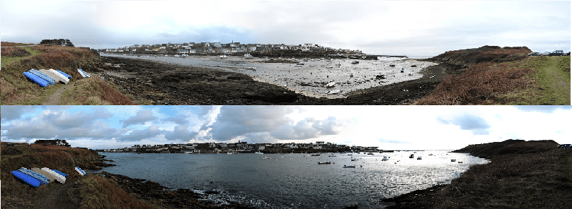
I hope that by now you have understood the nuance between location and localization. In coastal environments, when considering locations, we must add a quite unique characteristic: the locations are not necessarily fixed (permanent) in space. The most striking example is the case of water masses. Each water mass is characterized by a whole series of parameters (salinity, temperature,…). But they move. If you consider a beach, at a given moment, you will have a temperate coastal water mass. The next day you will find a cold water mass. If you are interested in the fate of pollutants, there is no point in mixing your observations: you are in the same place, but not, at all, the same localization. The concentration of such pollutant measured the day before will be compared with today’s concentration in the same water mass, but that water mass could be miles away.
But you may wonder where I am coming from. In fact, we tend to tackle the spatial analysis by focusing on gradients and disregarding the need to highlight the locations involved in our study. The complexity and power of today’s geomatics tools make it possible to obtain quite satisfactory results, even when our intellectual approach is not rigorous. It is a trap that forces the geomatician to, always, ask himself what does, actually, do the tool he is using, about the data, and the assumptions supposed to abide by.
The most outrageous example is the application of kriging methods to coastal data that do not respect the principle seasonality of the average. The stability of the average assumes that the average is constant between samples and is independent of the location of the samples. If you want to make a bathymetric chart on a littoral zone, you will have a different average depending on whether you are near the coast or far offshore. You can ignore this and realize your kriging, you will have a result that will seem correct even if it is mathematically and conceptually wrong. The correct procedure is to start by determining the trend of the data, remove it from input values (which makes the average stable), to realize kriging and to add the tendency to the result.
The result will be different in the two approaches; the second is much acute and highlights those hidden features at a first glance. On the other hand, following the first step you will spend hours to obtain almost the same result as using an IDW interpolation method that requires a few minutes work.
While the presence of spatial autocorrelation poses an analytical challenge, there are a number of practical benefits from its integration into the coastal environments analysis:
- to quantify the extent and pattern of spatial dependence in coastal areas,
- to determine the presence of redundant information in the field data sets,
- to quantify the nature and extent to which the basic assumptions of classical (non-spatial) statistics are not respected,
- to determine the extent to which an observed model is spatial in nature or not, and
- to allow the use of spatially structured model components to fill the gap of missing variables.
In the next article we will address another important aspect of spatial analysis in coastal areas: the spatial and temporal scales of the analysis.
Good post! Thanks!!