Blog GIS & Territories

GIS coaching for territorial management.

  • Blog – English
  • All Content
  • Old Maps
  • About/Contact
  • Forums.
  • EnglishEnglish
    • FrançaisFrançais
    • EnglishEnglish
    • EspañolEspañol
    • PortuguêsPortuguês

Tag: cartographic

2 May 202324 June 2023 Atilio Francois No Comments
  • Felt
  • QGis

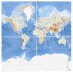
Integrating a WMTS raster tile service in QGis 3 and Felt

What is WMTS? A good example of a WMTS service is OpenStreetMap. It consists of an address to which client programs can request geotagged images. When you load OSM into QGis, the program connects to the…

Read More
  • Blog – English
  • All Content
  • Old Maps
  • About/Contact
  • Forums.
  • EnglishEnglish
Copyright 2018. All rights reserved | Theme: Blog Mantra by LilyTurf Themes