Blog GIS & Territories

GIS coaching for territorial management.

  • Blog – English
  • All Content
  • Old Maps
  • About/Contact
  • Forums.
  • EnglishEnglish
    • FrançaisFrançais
    • EnglishEnglish
    • EspañolEspañol
    • PortuguêsPortuguês

Tag: georeferencing

9 May 20235 May 2023 Atilio Francois No Comments
  • QGis

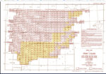
Perry-Castañeda Library-southern europe 1943 maps: How to georeference?

The Perry-Castañeda Library Map Collection, located at the University of Texas, is one of the largest digital map collections in the world. This collection contains maps of all continents and many countries, as well as topographic,…

Read More
Besoin de conseils, assistance, formation?
Visitez le site de NASCA et découvrez toutes nos offres de coaching SIG
Cliquez ici

Voir le profil de atilio francois sur LinkedIn

Articles récents

  • Installing the QGIS- Semi-Automatic Classification (SCP) v 8.0 plugin
  • QGis for LIDAR: digital feature model (DEM) with Open Lidar Tools.
  • QGis for LIDAR: digital terrain model (DTM) with LAStools.
  • QGis for LIDAR: digital terrain model (DTM) with CloudCompare.
  • QGis for LIDAR: digital surface model (DSM) with CloudCompare and LAStools

Commentaires récents

  1. Pat on S57 Charts with QGis: display soundings16 April 2023

    Thank you for this

  2. Pat on Displaying marine charts with S57 QGis16 April 2023

    Thank you. I have just seen you new article of how to produce the soundg z layer so you have…

  3. Atilio Francois on Displaying marine charts with S57 QGis16 April 2023

    Hello If you are looking for the value of the probes in soundg.shp, you will not find them. Simply because…

  4. Pat on Displaying marine charts with S57 QGis16 April 2023

    Thank you for the method. Has anyone managed to bring the SOUNDG layer in and successfully display depths please? I…

  5. de backer on Hydrology with a GIS, for dummies (who we are): calculating the runoff (1)21 December 2022

    Mr, Are the other articles (methods for calculating runoff) not online ? thanks for your reply. Salutations.

Tous les articles par catégorie (cliquez sur une catégorie pour afficher les extraits des articles)

(Vous pouvez copier le lien RSS de chaque catégorie séparément)

  • ArcGis (1)
  • Arcgis Pro (1)
  • bibliography (1)
  • Database (10)
    • PostgreSQL (7)
    • Spatialite (3)
  • english posts (20)
  • Felt (3)
  • Geoserver (3)
  • GIS and management (2)
  • Lidar (9)
  • Non classé (204)
  • Outils divers (2)
  • QGis (28)

  • Blog – English
  • All Content
  • Old Maps
  • About/Contact
  • Forums.
  • EnglishEnglish
Copyright 2018. All rights reserved | Theme: Blog Mantra by LilyTurf Themes