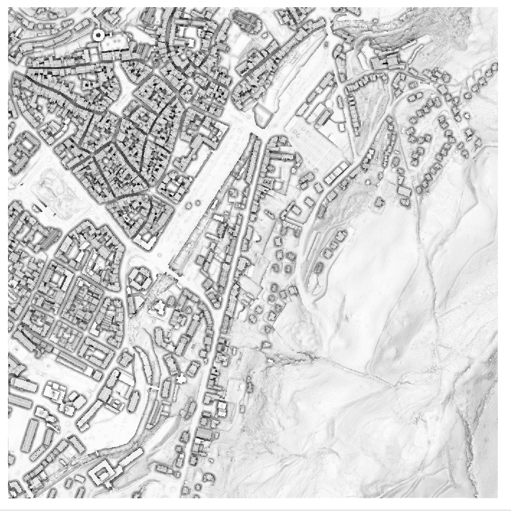
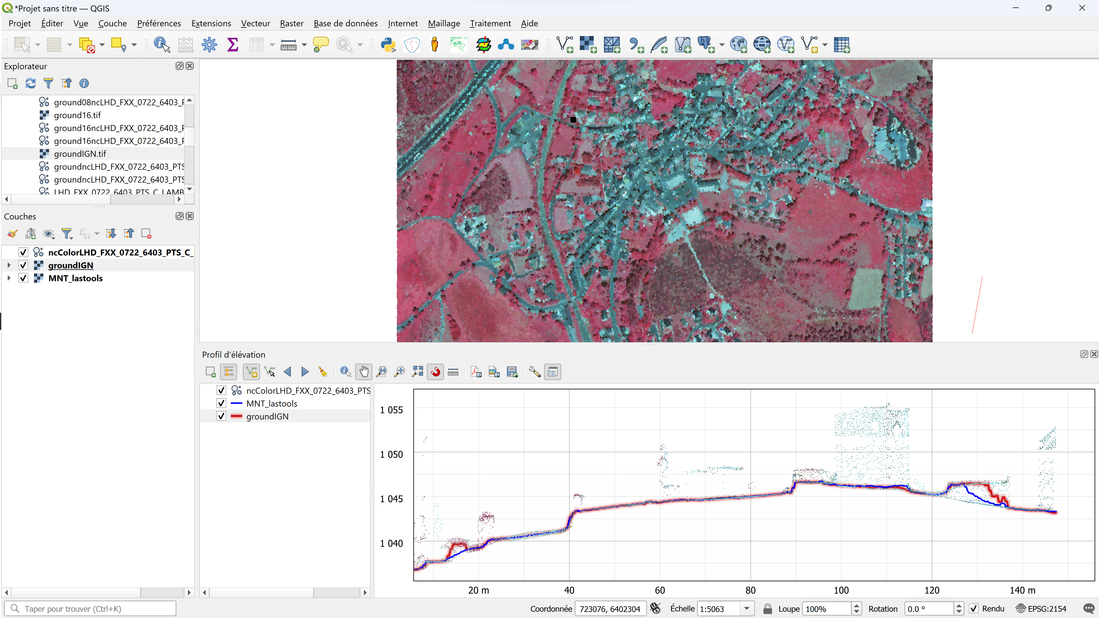
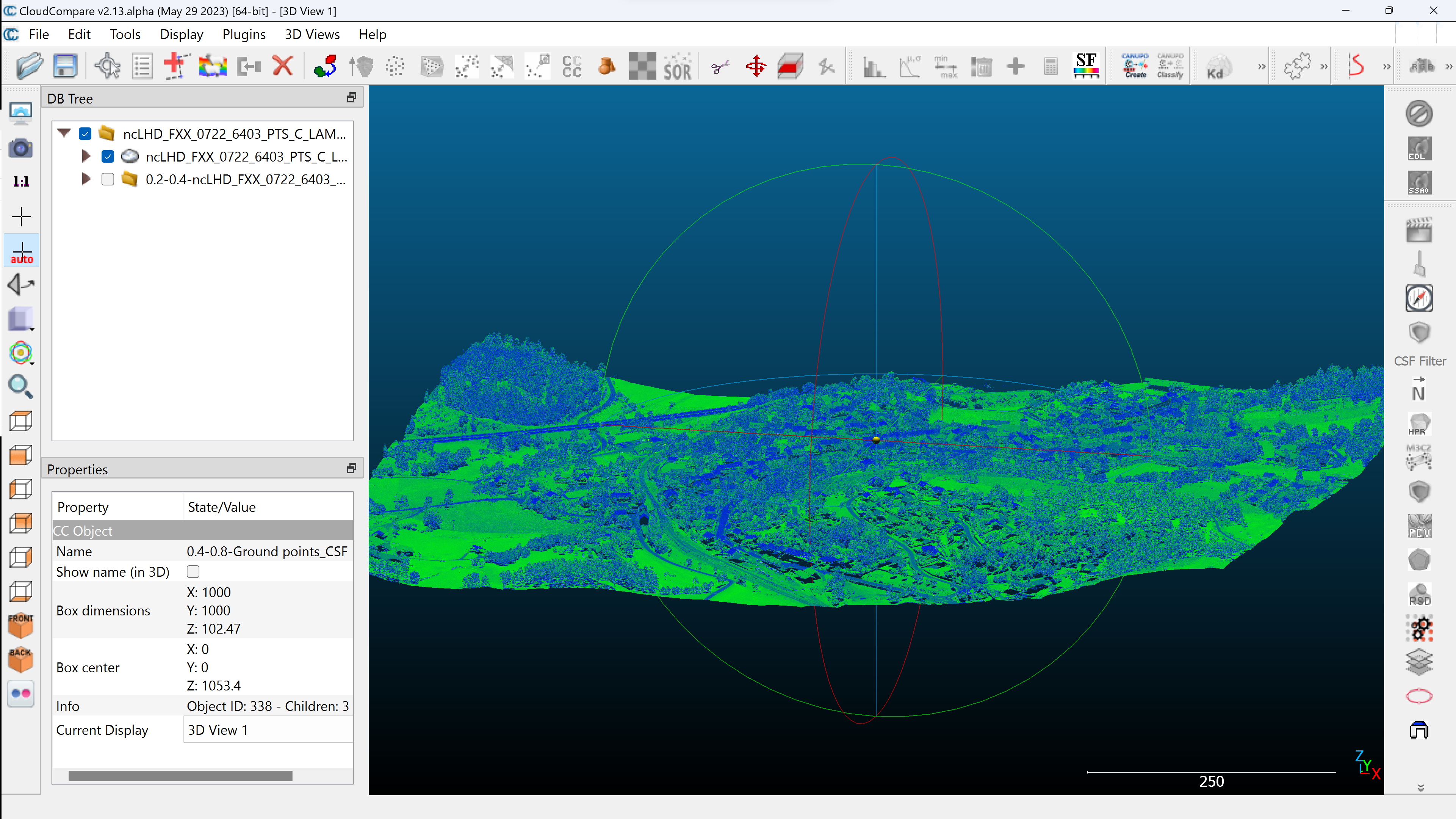
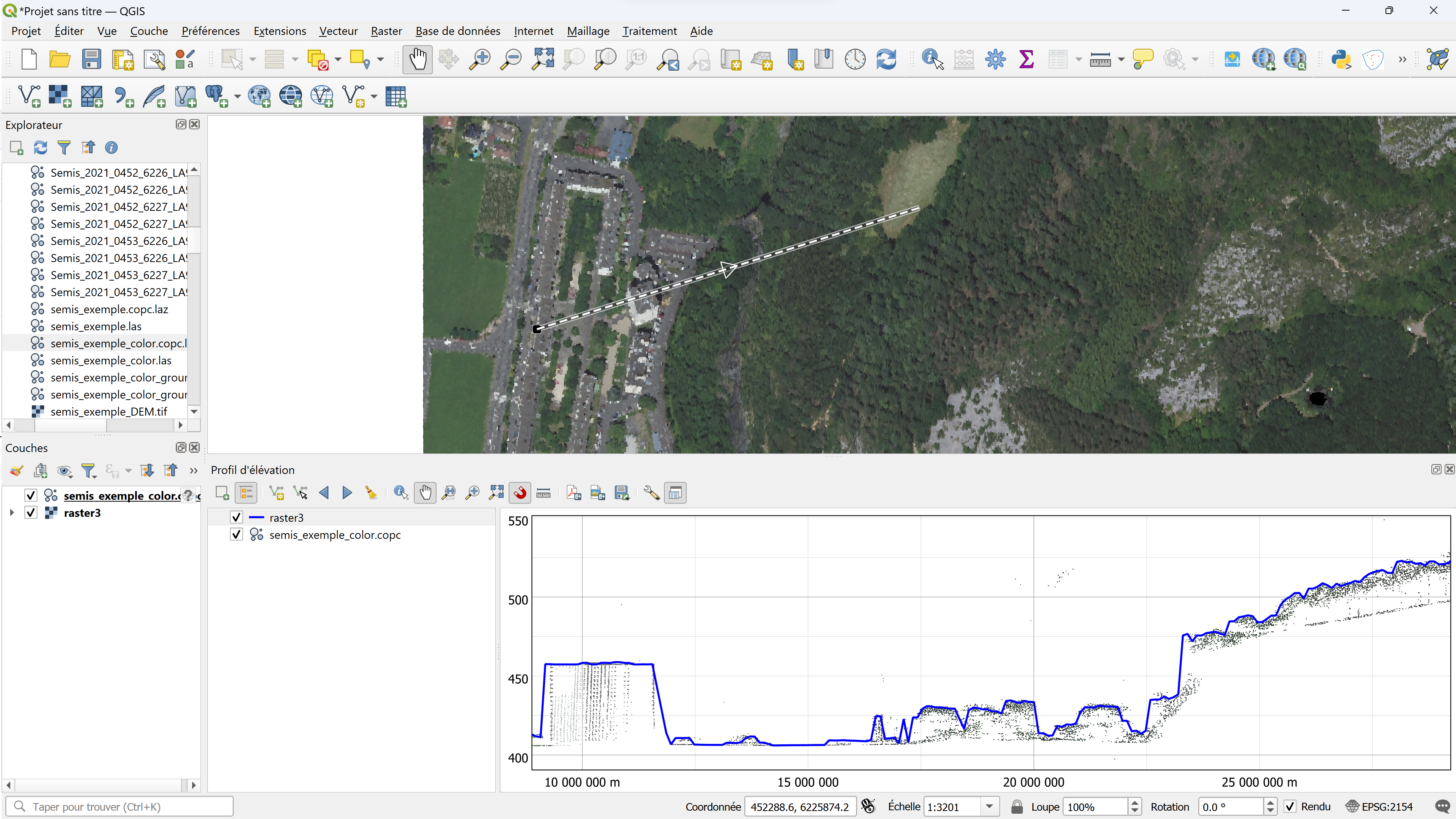
Blog GIS & Territories

GIS coaching for territorial management.

  • Blog – English
  • All Content
  • Old Maps
  • About/Contact
  • Forums.
  • EnglishEnglish
    • FrançaisFrançais
    • EnglishEnglish
    • EspañolEspañol
    • PortuguêsPortuguês

Tag: lidar

30 August 202330 August 2023 Atilio Francois No Comments
  • Lidar
  • QGis

QGis for LIDAR: digital feature model (DEM) with Open Lidar Tools.

In this article you’ll find out how to create a Digital Feature Model in just a few clicks and visualize the results, thanks to the Open Lidar Toolbox plugin. Tutorial HD LIDAR data processing with QGis…

Read More
10 August 202310 August 2023 Atilio Francois No Comments
  • Lidar

QGis for LIDAR: digital terrain model (DTM) with LAStools.

In this article, you’ll find step-by-step instructions on how to create a DTM from an unclassified and classified LIDAR cloud, using LAStools and QGis. We’ll look at the LASground and LASground_new tools, las2dem and lastile. Tutorial…

Read More
8 August 20238 August 2023 Atilio Francois No Comments
  • Lidar

QGis for LIDAR: digital terrain model (DTM) with CloudCompare.

QGis for LIDAR:digital terrain model (DTMIn this article you will find the definition of a digital terrain model and, step by step, how to create a DTM from an unclassified and classified LIDAR cloud, using CloudCompare…

Read More
3 August 20233 August 2023 Atilio Francois No Comments
  • Lidar

QGis for LIDAR: digital surface model (DSM) with CloudCompare and LAStools

In this article you’ll find the definition of a digital surface model and, step by step, how to create a DSM from an unclassified and classified LIDAR cloud, using CloudCompare and LAStools. Tutorial : LIDAR HD…

Read More
1 August 202330 July 2023 Atilio Francois No Comments
  • Lidar

QGis for LIDAR:Colorize from an image with LAStools

In this article you’ll find out how to transfer colors (colorize) from an image or orthophoto to the points of a LIDAR cloud, using the LAStools toolbox in QGis to render LIDAR as if it were…

Read More
27 July 202328 July 2023 Atilio Francois No Comments
  • Lidar

QGis for LIDAR:colorizing from an image

Tutoriel : LIDAR HD avec QGIS 3.32 In this article you’ll find out how to transfer colors (colorize) from an image or orthophoto to the points of a LIDAR cloud using CloudCompare. The result is an…

Read More
25 July 202326 August 2023 Atilio Francois No Comments
  • Lidar

QGis 3.32: Tools for LIDAR data

Tutorial: HD LIDAR with QGIS 3.32 In this article you’ll find tools for LIDAR data: LASTools, WhiteboxTools, OpenLIDAR Tools. Step-by-step installation, licensing and configuration. You’ll also find a presentation of CloudCompare. As we saw in the…

Read More
18 July 202313 July 2023 Atilio Francois No Comments
  • Lidar

LIDAR data in QGis 3.32

Among many improvements, version 3.32 introduces the long-awaited feature of native point cloud processing in QGIS, enabling QGIS Desktop to become a powerful LiDAR data processing utility. Before publishing a tutorial on the new features, I’ve…

Read More
6 June 20235 June 2023 Atilio Francois No Comments
  • QGis

How to create a topographic profile with QGis 3.26 (Part 3)

Here’s a 5-chapter tutorial on the new QGis feature in version 3.26: elevation profiles. Chapter 1: Profiles from vector layers Chapter 2: Profiles from raster layers Chapter 3: Profiles from point clouds (Lidar) Chapter 4: Profiles…

Read More
  • Blog – English
  • All Content
  • Old Maps
  • About/Contact
  • Forums.
  • EnglishEnglish
Copyright 2018. All rights reserved | Theme: Blog Mantra by LilyTurf Themes