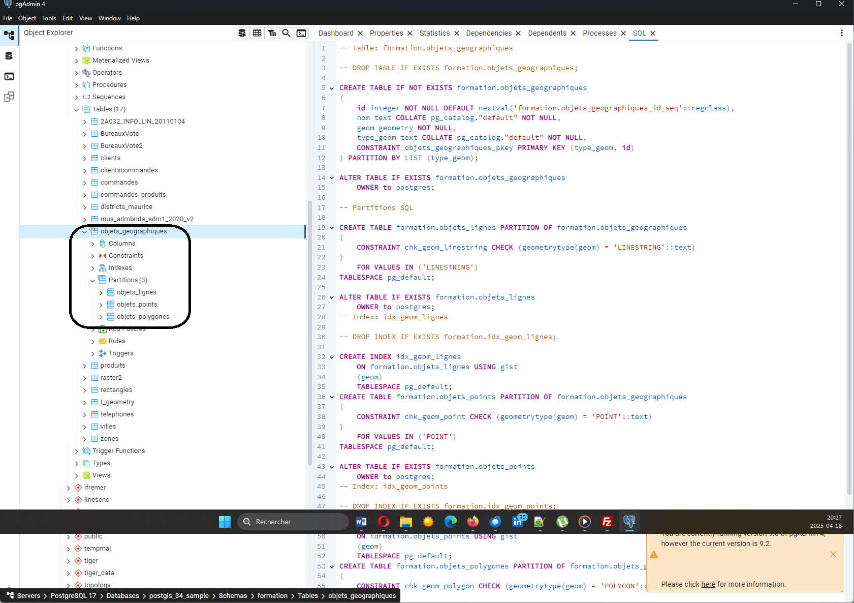
Spatial analysis with SQL: 5- aggregation function (ArcGis Union)

In Article previous we have discussed some SQL functions for spatial processing . In this article we will see a function a little more complicated to put at work: the aggregation function for two layers of polygons. This operation is the one called Union in ArcGis. The purpose of the… Continuer à lire…

Replicating a postgresql database in a windows workstation

We will configure a logic   replication of a database table of our linux server in a postgresql installation in a windows workstation. The replication allows us to keep an updated copy of the centralized database in a remote station. This copy will not be used for local updates since it will be read-only. On… Continuer à lire…

How to rectify the geometry of a Postgis table

We have already discussed the topic of geometry validation through a series of articles (in french): GIS tools for validation of geometries (1) Geometry validation GIS tools (2): Spatiality and PostGis Geometry validation tools (3): FME Geometry validation tools (4): Geomedia Intergraph Geometry validation tools (5) with QGis In this… Continuer à lire…