Blog GIS & Territories

GIS coaching for territorial management.

  • Blog – English
  • Tutorials
    • Leaflet Initiation
  • All Content
  • Old Maps
  • Plugins QGis(en)
    • FuzzyAttributes(en)
  • About/Contact
  • English
    • Français
    • English
    • Español
    • Português

Tag: qgis

15 July 20251 July 2025 Atilio Francois No Comments
  • Plugin
  • QGis

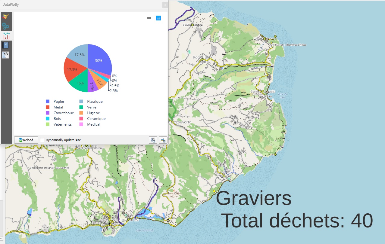
Building an interactive dashboard in QGIS: dynamic analysis with Data Plotly, widgets and expressions

Objective Create a dynamic monitoring interface in QGIS with : All without leaving the QGIS interface! Use case: monitoring beach litter Let’s take our releves_dechets layer with : Field Description beach Name of beach type_waste Waste…

Read More
7 July 202527 June 2025 Atilio Francois No Comments
  • Plugin
  • QGis

Automatically export a series of feature-based graphics with QGIS and Python (without Data Plotly)

In our previous articles, we looked at how to create graphs in QGIS with Data Plotly. Today, we’re going one step further: automate the generation of a graph by range (or any other entity), exporting the…

Read More
2 July 202521 June 2025 Atilio Francois No Comments
  • Plugin
  • QGis

Crossing spatial selection and graphic analysis in QGIS with Data Plotly

In our previous article, we discovered how to use the Data Plotly plugin to create graphs directly in QGIS. Today, let’s go a step further and learn how to dynamically filter the data displayed in graphs,…

Read More
27 June 202520 June 2025 Atilio Francois No Comments
  • Plugin
  • QGis

Visualize your GIS data in QGIS with the Data Plotly plugin

QGIS is a powerful Geographic Information System (GIS) software, renowned for its modularity thanks to its numerous plugins. Among these, Data Plotly stands out for its ability to create interactive graphics directly from GIS layers. A…

Read More
25 June 202514 June 2025 Atilio Francois No Comments
  • QGis

Heatmaps and hotspot maps in QGIS

Heatmaps and hotspot maps in QGIS: understanding the differences In spatial analysis, heatmaps and hotspot maps are two powerful techniques for revealing concentrations or areas of interest from geographic data. While their appearance may be similar…

Read More
20 June 202514 June 2025 Atilio Francois No Comments
  • QGis

Easily add base maps to QGIS: three practical methods compared

Introduction Adding map backgrounds is a key step in visualizing spatial data with QGIS. Whether it’s to contextualize your layers, create a beautiful printable map, or simply to better interpret your data, quickly having a background…

Read More

Posts pagination

« Previous 1 2 3 4 … 11 Next »

Mastodon Follow me on Mastodon
Voir le profil de atilio francois sur LinkedIn

Recent articles

  • Exporting a QGIS layout to SVG: uses, limitations, and solutions
  • Associating points with their municipality or zone: simple spatial joins with MMQGIS
  • Geocoding place names and finding an address from GPS coordinates with QGIS + MMQGIS
  • Work or train independently: create a portable QGIS environment
  • Building a consistent, reusable QGIS environment: bookmarks, project templates and automation

Recent comments

  1. Atilio Francois on How to develop an application with pgrouting in Windows (1)25 August 2025

    You're right — since 2019 Geofabrik no longer provides plain `.osm` files, only the compressed `.osm.pbf` format. The tool **osm2pgrouting**…

  2. Simon on How to develop an application with pgrouting in Windows (1)25 August 2025

    The osm downloads don't appear to be available, just osm.pfb And osm2pgrouting on Windows doesn't like pbf "not well formed…

  3. Arno on Portable version of QGis 3.32.021 August 2025

    I just want to thank you. It works.

  4. Atilio Francois on Portable version of QGis 3.32.015 May 2025

    What is the link between the qgis update and the portable version? A portable version cannot be updated; it must…

  5. Hugo on Portable version of QGis 3.32.014 May 2025

    For me, the error message complaining that qgis_app.dll is missing started appearing following the most recent QGIS update.

All articles by category (click on a category to display article extracts)

(You can copy the RSS link for each category separately)

  • ArcGis (1)
  • Arcgis Pro (1)
  • bibliography (1)
  • Database (12)
    • PostgreSQL (9)
    • Spatialite (3)
  • english posts (20)
  • Felt (3)
  • Geoserver (5)
  • GIS and management (2)
  • Lidar (10)
  • Non classé (206)
  • Outils divers (2)
  • Postgis (1)
  • QGis (52)
    • Plugin (9)
  • webmapping (9)

  • Blog – English
  • Tutorials
  • All Content
  • Old Maps
  • Plugins QGis(en)
  • About/Contact
  • English
Copyright 2018. All rights reserved | Theme: Blog Mantra by LilyTurf Themes