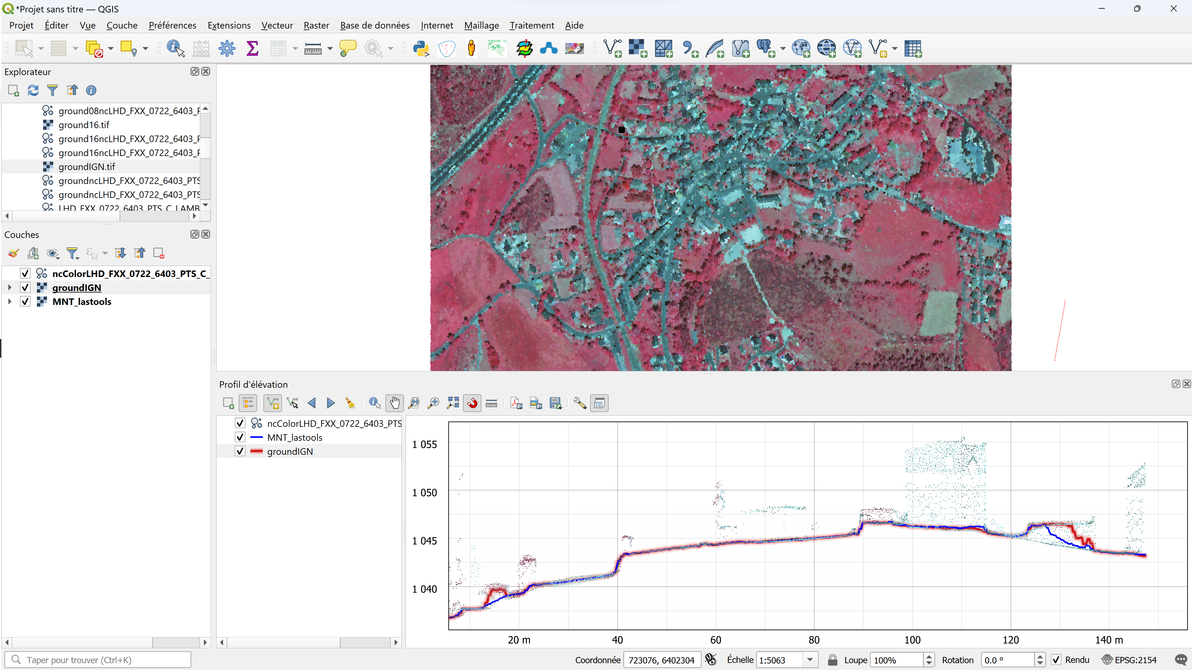
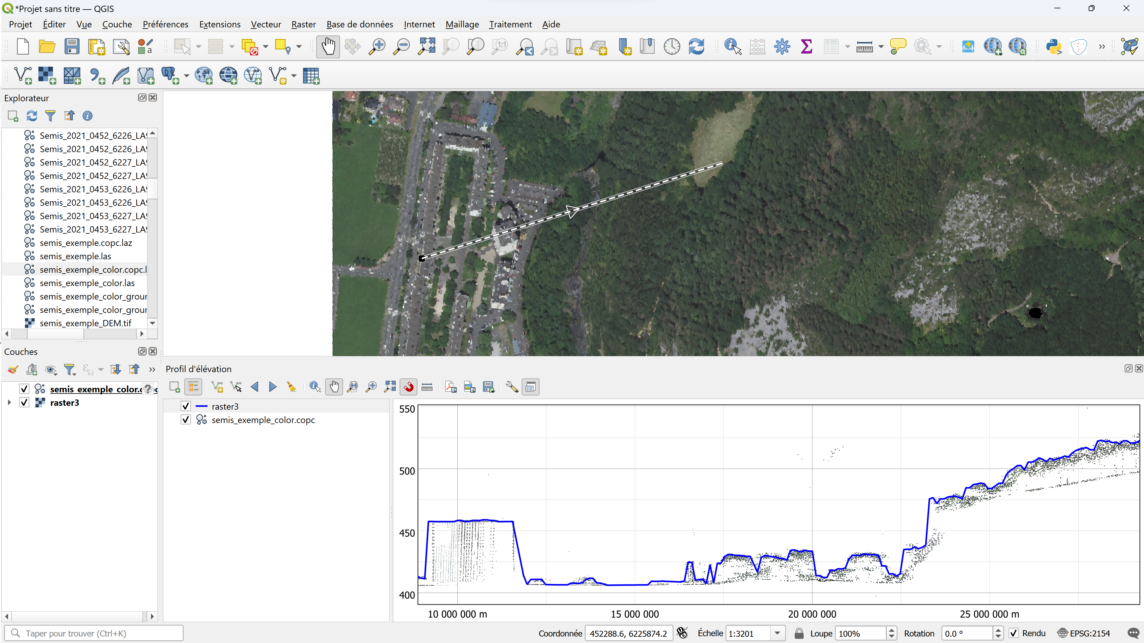
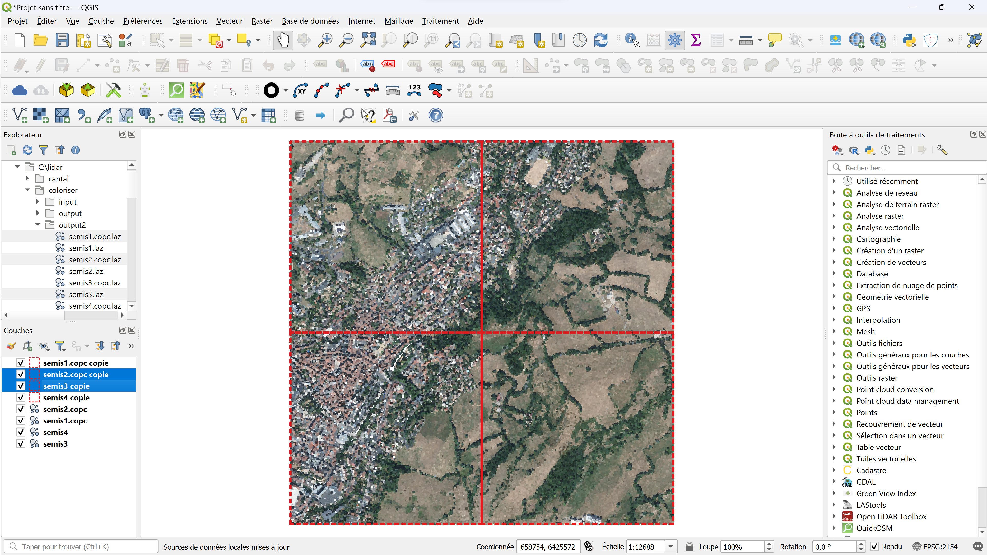
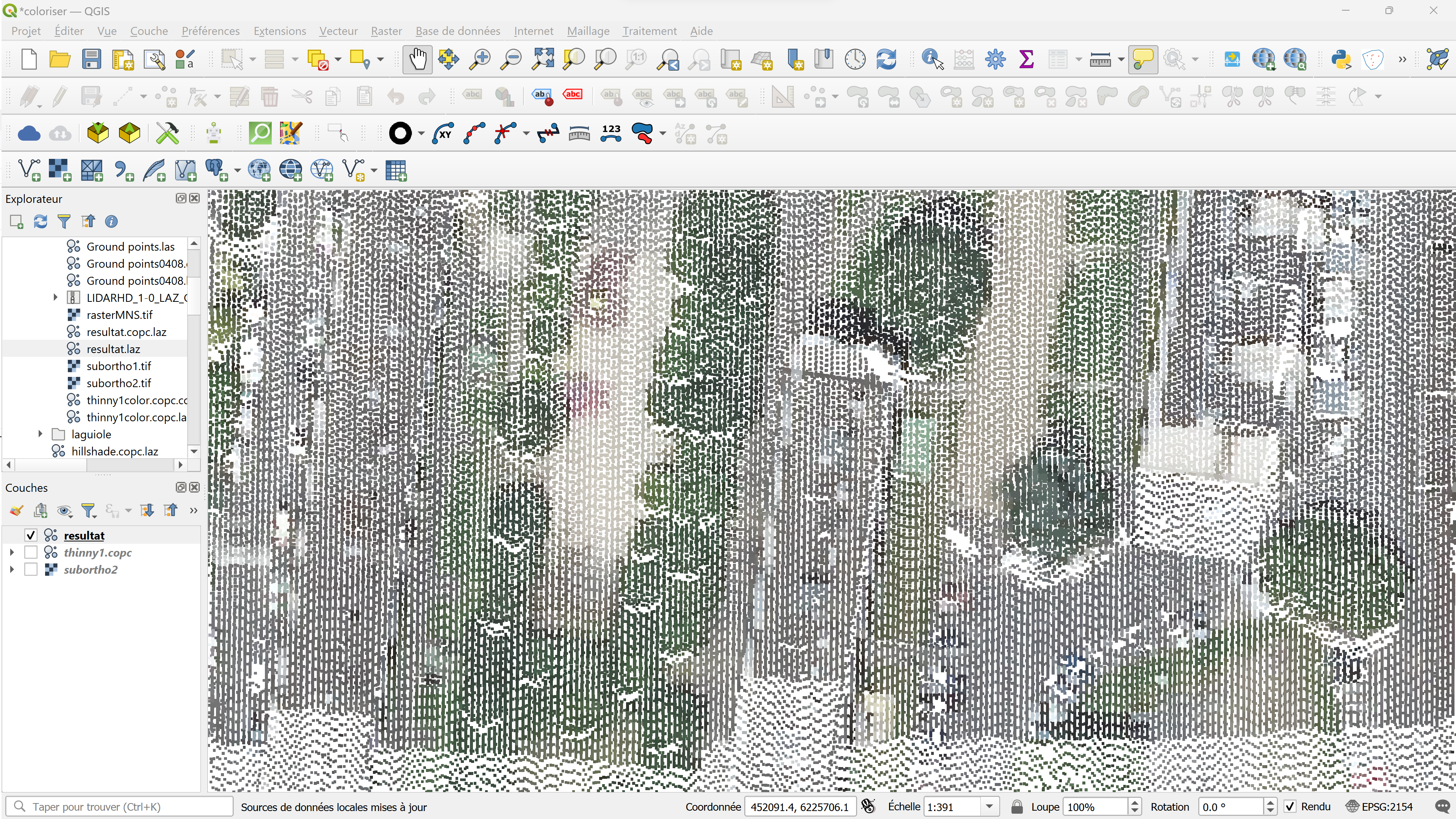
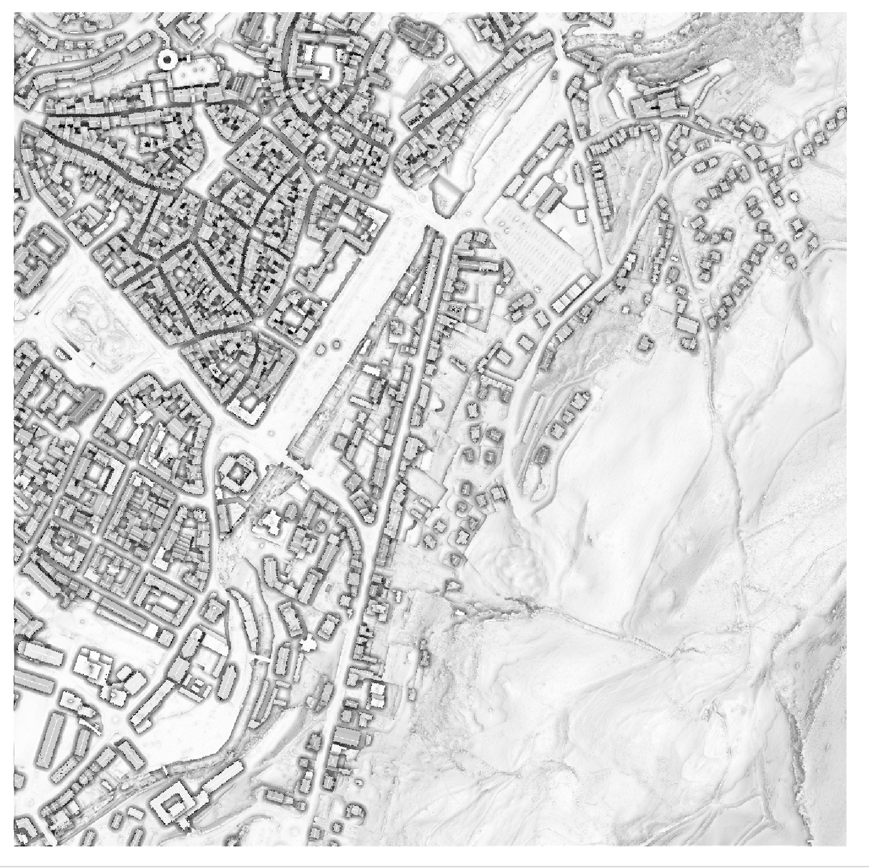
Blog GIS & Territories

GIS coaching for territorial management.

  • Blog – English
  • Tutorials
    • Leaflet Initiation
  • All Content
  • Old Maps
  • Plugins QGis(en)
    • FuzzyAttributes(en)
  • About/Contact
  • English
    • Français
    • English
    • Español
    • Português

Tag: qgis

1 August 202325 April 2025 Atilio Francois No Comments
  • Lidar

QGis for LIDAR:Colorize from an image with LAStools

In this article you’ll find out how to transfer colors (colorize) from an image or orthophoto to the points of a LIDAR cloud, using the LAStools toolbox in QGis to render LIDAR as if it were…

Read More
27 July 202325 April 2025 Atilio Francois No Comments
  • Lidar

QGis for LIDAR:colorizing from an image

Tutoriel : LIDAR HD avec QGIS 3.32 In this article you’ll find out how to transfer colors (colorize) from an image or orthophoto to the points of a LIDAR cloud using CloudCompare. The result is an…

Read More
25 July 202326 August 2023 Atilio Francois No Comments
  • Lidar

QGis 3.32: Tools for LIDAR data

Tutorial: HD LIDAR with QGIS 3.32 In this article you’ll find tools for LIDAR data: LASTools, WhiteboxTools, OpenLIDAR Tools. Step-by-step installation, licensing and configuration. You’ll also find a presentation of CloudCompare. As we saw in the…

Read More
20 July 202322 July 2023 Atilio Francois No Comments
  • Lidar

Loading IGN France HD Lidar data

Tutorial: HD LIDAR with QGIS 3.32 1- Download LIDAR HD data from IGN and load it into QGis Downloading data You can download IGN Lidar data from the following address: https://geoservices.ign.fr/lidarhd. On the right you’ll find…

Read More
18 July 202313 July 2023 Atilio Francois No Comments
  • Lidar

LIDAR data in QGis 3.32

Among many improvements, version 3.32 introduces the long-awaited feature of native point cloud processing in QGIS, enabling QGIS Desktop to become a powerful LiDAR data processing utility. Before publishing a tutorial on the new features, I’ve…

Read More
13 July 202311 July 2023 Atilio Francois No Comments
  • QGis

QGis network analysis tools:service area

In network analysis with QGIS, a service area refers to a geographic zone that is covered or served by a specific transportation or distribution network. This can include elements such as roads, public transit lines, water…

Read More

Posts pagination

« Previous 1 … 4 5 6 7 8 … 11 Next »

Mastodon Follow me on Mastodon
Voir le profil de atilio francois sur LinkedIn

Recent articles

  • Fuzzy aggregation of two raster layers with FuzzyAttributes V2
  • Converting a class raster to a fuzzy raster in QGIS
  • Converting a raster into fuzzy values with FuzzyAttributes V2
  • Consultation and negotiation: the contribution of fuzzy logic
  • PostGIS 3.6 released – 3D, raster, and topology take a leap forward

Recent comments

  1. Atilio Francois on How to develop an application with pgrouting in Windows (1)25 August 2025

    You're right — since 2019 Geofabrik no longer provides plain `.osm` files, only the compressed `.osm.pbf` format. The tool **osm2pgrouting**…

  2. Simon on How to develop an application with pgrouting in Windows (1)25 August 2025

    The osm downloads don't appear to be available, just osm.pfb And osm2pgrouting on Windows doesn't like pbf "not well formed…

  3. Arno on Portable version of QGis 3.32.021 August 2025

    I just want to thank you. It works.

  4. Atilio Francois on Portable version of QGis 3.32.015 May 2025

    What is the link between the qgis update and the portable version? A portable version cannot be updated; it must…

  5. Hugo on Portable version of QGis 3.32.014 May 2025

    For me, the error message complaining that qgis_app.dll is missing started appearing following the most recent QGIS update.

All articles by category (click on a category to display article extracts)

(You can copy the RSS link for each category separately)

  • ArcGis (1)
  • Arcgis Pro (1)
  • bibliography (1)
  • Database (12)
    • PostgreSQL (9)
    • Spatialite (3)
  • english posts (20)
  • Felt (3)
  • Geoserver (5)
  • GIS and management (2)
  • Lidar (10)
  • Logique floue (2)
  • Non classé (206)
  • Outils divers (2)
  • Postgis (2)
  • QGis (61)
    • Plugin (17)
  • webmapping (9)

  • Blog – English
  • Tutorials
  • All Content
  • Old Maps
  • Plugins QGis(en)
  • About/Contact
  • English
Copyright 2018. All rights reserved | Theme: Blog Mantra by LilyTurf Themes