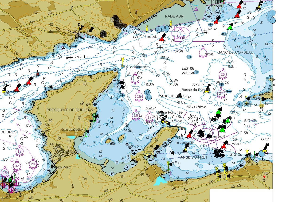
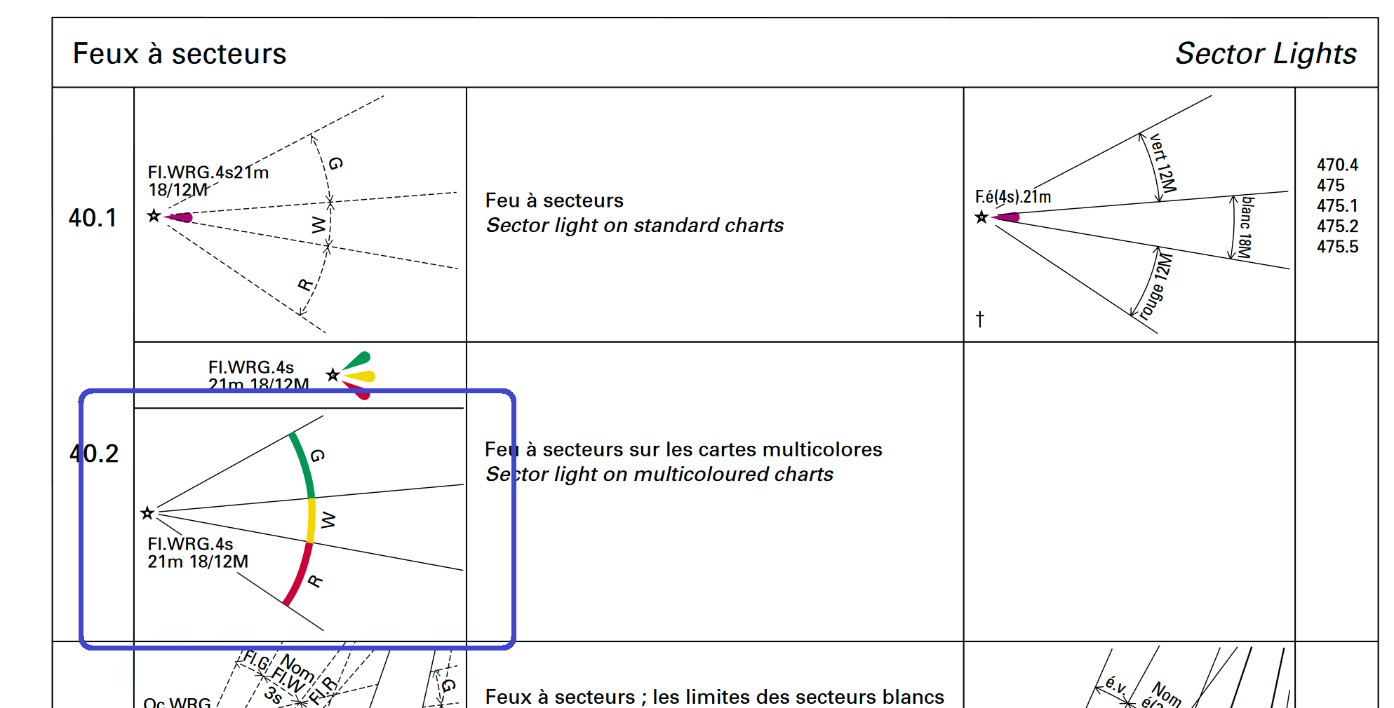
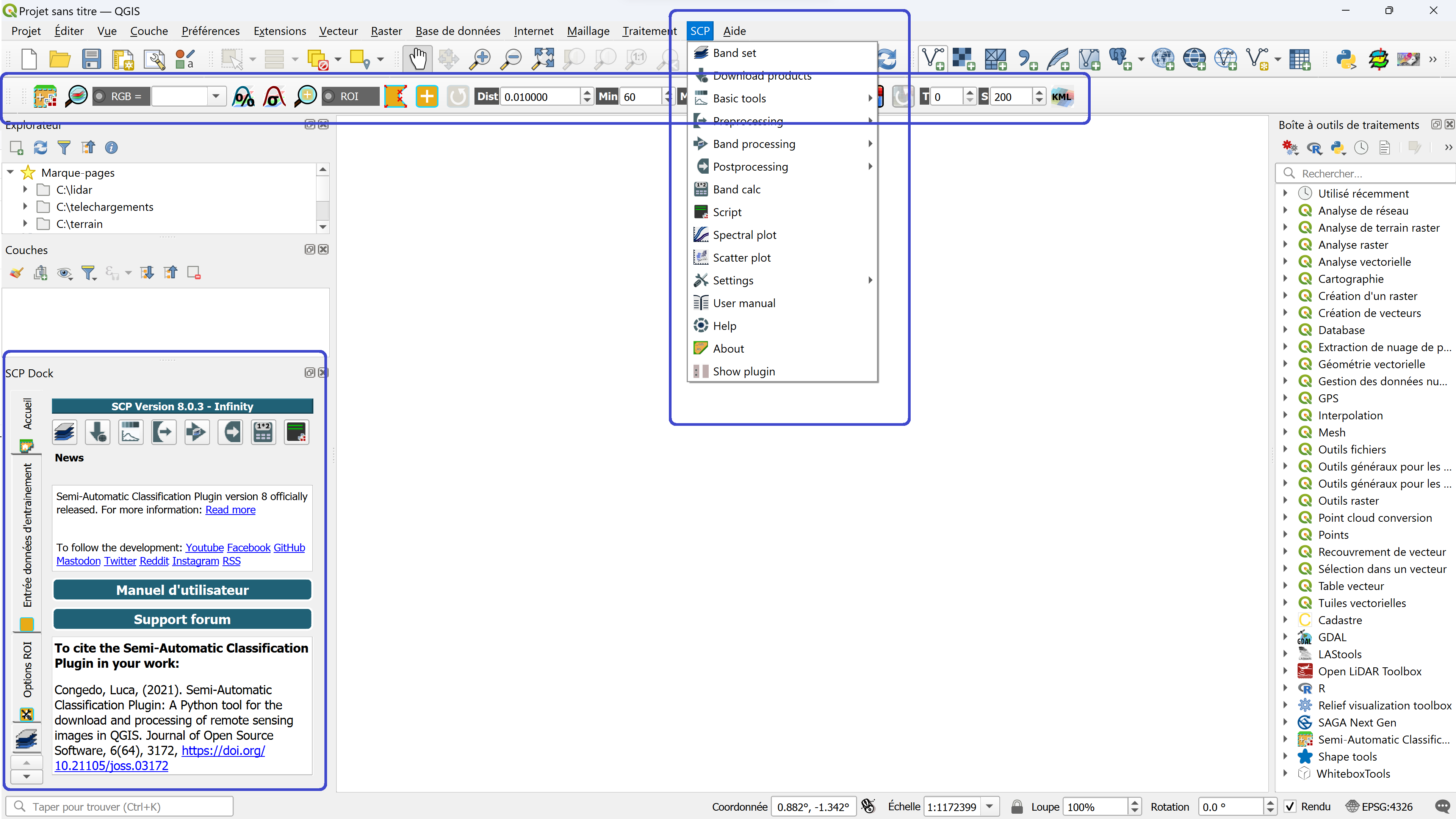
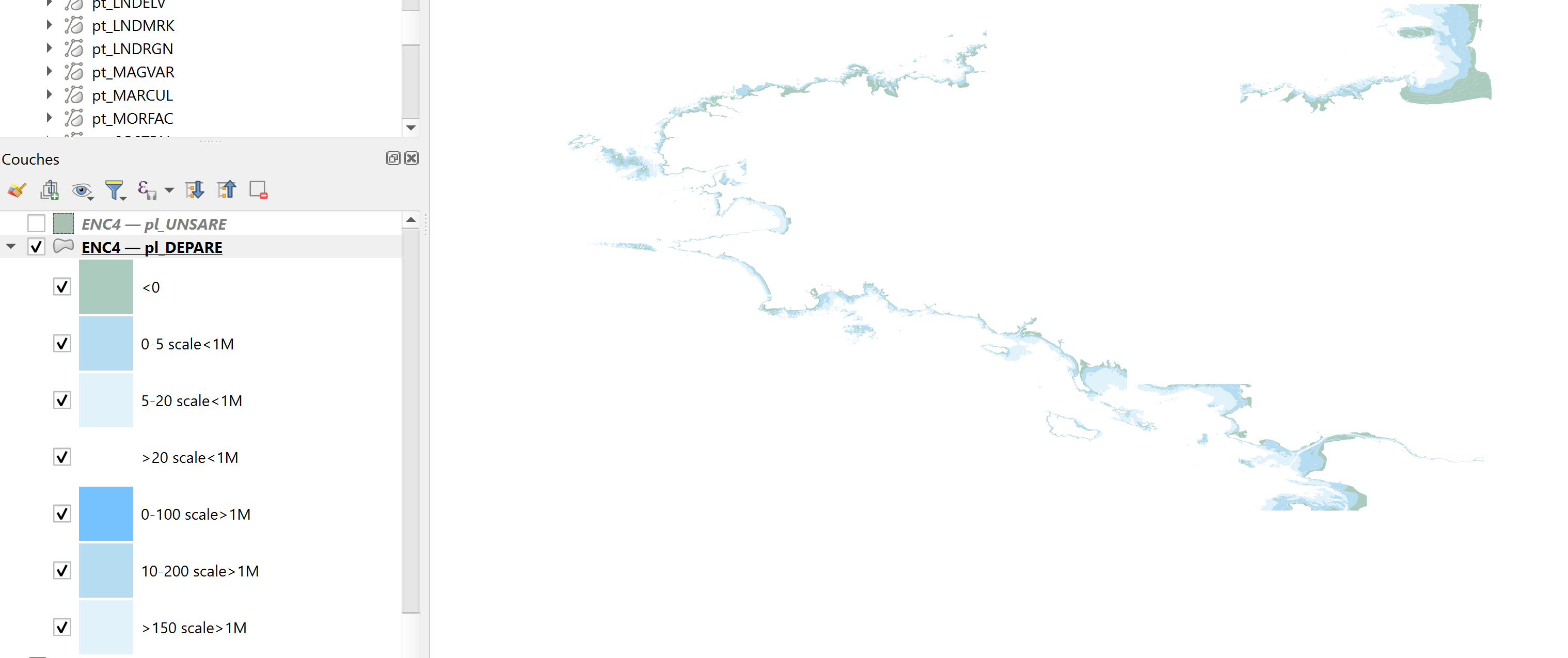
Blog GIS & Territories

GIS coaching for territorial management.

  • Blog – English
  • Tutorials
    • Leaflet Initiation
  • All Content
  • Old Maps
  • Plugins QGis(en)
    • S57Manager(en)
    • FuzzyAttributes(en)
  • About/Contact
  • English
    • Français
    • English
    • Español
    • Português

Tag: qgis

11 January 202411 January 2024 Atilio Francois No Comments
  • Non classé

Collaborative Funding for Marine Data Integration in QGIS

Dear friends of the marine community and GIS enthusiasts, We’re delighted to present an exciting project aimed at improving the visualization of marine data in QGIS. Our goal is to make this information more accessible, understandable…

Read More
9 January 20248 January 2024 Atilio Francois No Comments
  • Lidar
  • QGis

Lidar with QGis: Interpolation of the Digital Elevation Model (DEM)

In this article you’ll find out how to apply two types of interpolation (TLI and IDW) simultaneously to a LIDAR point cloud, having segmented the cloud into two types of zone. Tutorial HD LIDAR data processing…

Read More
12 October 202312 October 2023 Atilio Francois No Comments
  • QGis

Installing the QGIS- Semi-Automatic Classification (SCP) v 8.0 plugin

This article describes the installation of version 8.0.3 of the QGis SCP (semi-automatic classification) plugin on a 64-bit Windows machine. The new version of the QGis image classification plugin (SCP) is a little more complicated than…

Read More
30 August 202330 August 2023 Atilio Francois No Comments
  • Lidar
  • QGis

QGis for LIDAR: digital feature model (DEM) with Open Lidar Tools.

In this article you’ll find out how to create a Digital Feature Model in just a few clicks and visualize the results, thanks to the Open Lidar Toolbox plugin. Tutorial HD LIDAR data processing with QGis…

Read More
10 August 202310 August 2023 Atilio Francois No Comments
  • Lidar

QGis for LIDAR: digital terrain model (DTM) with LAStools.

In this article, you’ll find step-by-step instructions on how to create a DTM from an unclassified and classified LIDAR cloud, using LAStools and QGis. We’ll look at the LASground and LASground_new tools, las2dem and lastile. Tutorial…

Read More
8 August 20238 August 2023 Atilio Francois No Comments
  • Lidar

QGis for LIDAR: digital terrain model (DTM) with CloudCompare.

QGis for LIDAR:digital terrain model (DTMIn this article you will find the definition of a digital terrain model and, step by step, how to create a DTM from an unclassified and classified LIDAR cloud, using CloudCompare…

Read More

Posts pagination

« Previous 1 … 5 6 7 8 9 … 13 Next »

Mastodon Follow me on Mastodon
Voir le profil de atilio francois sur LinkedIn

Recent articles

Recent comments

posts

  1. Atilio Francois on [EN]Portable QGIS 4.0 for Windows – Download and use QGIS without installation5 June 2026

    Thank you for your feedback and for reporting these issues. The errors and the missing Processing functionality that you observed…

  2. Andrea on [EN]Portable QGIS 4.0 for Windows – Download and use QGIS without installation5 June 2026

    I've downloaded today the 7z file from https://www.sigterritoires.fr/QGis4.0Lite, then unarchived it and then launched launch_qgis_portable.bat: various errors occurs https://dcmnt.eu/pad/#/2/pad/view/-6FZXEyJYV4SyZmDWWE4XW6M7l-1JGp0V67X4tBTdjg/embed/ and…

  3. Andrea on [EN]Portable QGIS 4.0 for Windows – Download and use QGIS without installation5 June 2026

    It's not clear what are exactly the components that are missing in the "QGIS portable – lightweight version". Could you…

  4. Ed on Portable version of QGis 3.44.0 – Updated Version with Python Fixes and Authentication Support2 June 2026

    Thank you for your service to the community! Please know that you are greatly appreciated! We prefer using the Long…

  5. SERGIO SEBASTIAN VERDU on [EN]Portable QGIS 4.0 for Windows – Download and use QGIS without installation27 May 2026

    Hi Atilio, I'm very interested in downloading these versions of QGIS, but I've tried several times and the download never…

All articles by category (click on a category to display article extracts)

(You can copy the RSS link for each category separately)

  • ArcGis (1)
  • Arcgis Pro (1)
  • bibliography (1)
  • Database (13)
    • PostgreSQL (9)
    • Spatialite (3)
  • english posts (20)
  • Felt (3)
  • Geoserver (5)
  • Geospatial Technologies (4)
    • Spatial Analysis & GIS (4)
  • GIS and management (2)
  • IA(en) (3)
  • Lidar (10)
  • Logique floue (2)
  • Non classé (207)
  • Outils divers (2)
  • Outils et méthodes (5)
    • Images (5)
  • Postgis (4)
  • QGis (80)
    • Plugin (26)
    • Tutorial (6)
  • S57 (5)
  • webmapping (9)

  • Blog – English
  • Tutorials
  • All Content
  • Old Maps
  • Plugins QGis(en)
  • About/Contact
  • English
Copyright 2018. All rights reserved | Theme: Blog Mantra by LilyTurf Themes