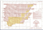
Perry-Castañeda Library-southern europe 1943 maps: How to georeference?

The Perry-Castañeda Library Map Collection, located at the University of Texas, is one of the largest digital map collections in the world. This collection contains maps of all continents and many countries, as well as topographic, nautical, geological, and historical maps. In particular, the 1943 topographic maps for Southern Europe… Continuer à lire…

How to find the coordinate system of a layer with QGis 3.X?

When working with spatial data in GIS software, you regularly encounter the problem of files that lack a clearly defined coordinate system. When a file lacks its coordinate system (CSR), it can lead to misaligned layers, incorrect measurements, and a host of other problems that hinder accurate data visualization and… Continuer à lire…