Loading IGN France HD Lidar data
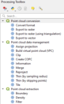
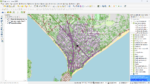
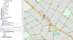
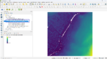
Tutorial: HD LIDAR with QGIS 3.32 1- Download LIDAR HD data from IGN and load it into QGis Downloading data You can download IGN Lidar data from the following address: https://geoservices.ign.fr/lidarhd. On the right you’ll find…
Read More